Tithe History

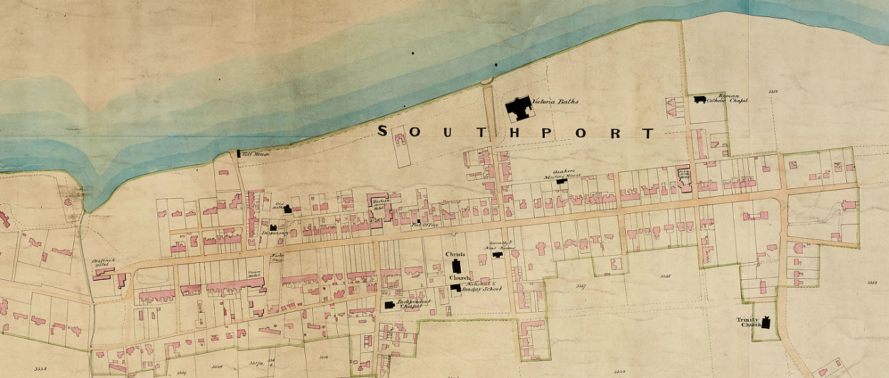
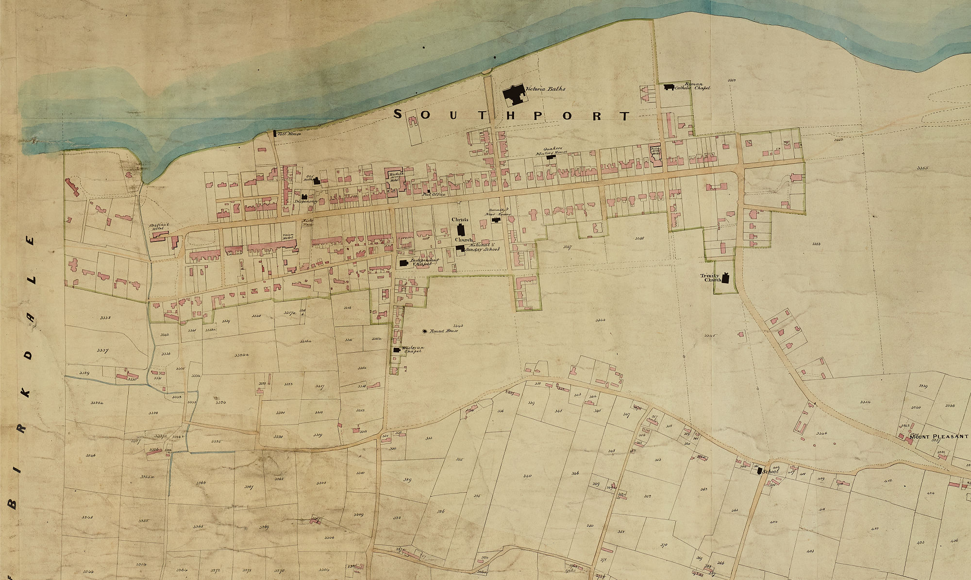
The North Meols tithe map was surveyed in chief by Thomas Maddock, Surveyor, Southport in 1839 and completed by Henry White, Land surveyor, Warrington 1840.
The early development of Southport
Perhaps the most significant feature about the parish of North Meols where Southport as a town later emerged is that within the perimeter of the coastal sand dunes at South Hawes (near the Birkdale boundary) the recreation of sea bathing developed and the construction of bathing houses for accommodation. Although this seaside resort development was not an isolated instance in the Victorian period as it developed in many places
It seems that for Southport a local innkeeper, William Sutton, encouraged this development and is credited with the South Port Hotel in 1798. Doubts remain, however, about the “true founders of Southport” (Bailey, A History of Southport 1955) and credence is due to native cottagers who resided in the area and earned a probably precarious living from farming and fishing. These established families were called Sandgrounders having been born on sand land.
Tithe History
Tithes were a means of deducting ten per cent of the produce of a local community to maintain a priest and his Church and are of considerable antiquity. Tithes certainly existed in England before the introduction of Christianity. Principally identified with a subsistence economy where payment in kind was the customary transaction and where a priest acted as a servant of the community. In a predominantly rural medieval economy it was difficult to hide the “fruits of the earth” but even so it was tempting to evade payment. As the market economy developed and wealth creation took new forms it became both more difficult to administer the tithe system and more tempting to avoid its payment. By the beginning of the nineteenth century complications had multiplied sufficiently to demand reform. The Tithe Commutation Act of 1836 established a settlement which substituted a money payment (or rent-charge) in place of customary payments in kind.
Tithe Surveys
This reform required detailed field surveys of parishes and townships across England & Wales which included topographical detail as well as roads, buildings and field boundaries. It included details of land ownership, occupation and state of cultivation. There were some exceptions, for example where tithe had been commuted previously as a result of parliamentary enclosure.
The result of these field surveys was the creation of very detailed and accurate records of the state of agricultural land across England and Wales conducted on a county basis.
The definitive and comprehensive catalogue of this survey resulting from the Tithe Commutation Act of 1836 is The Tithe Maps of England & Wales: A Cartographic Analysis and County-by-County Catalogue by Kain & Oliver first published in 1995.
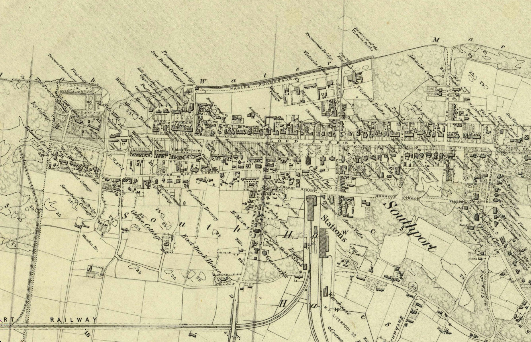
The two maps below show the difference in just a few years, the first map is the tithe map dating from 1839/40 and the second from the first o/s map dating from 1845, note the railway and station. The Liverpool, Crosby and Southport Line, opened in 1848.
Please click on the images for a larger version.